
|
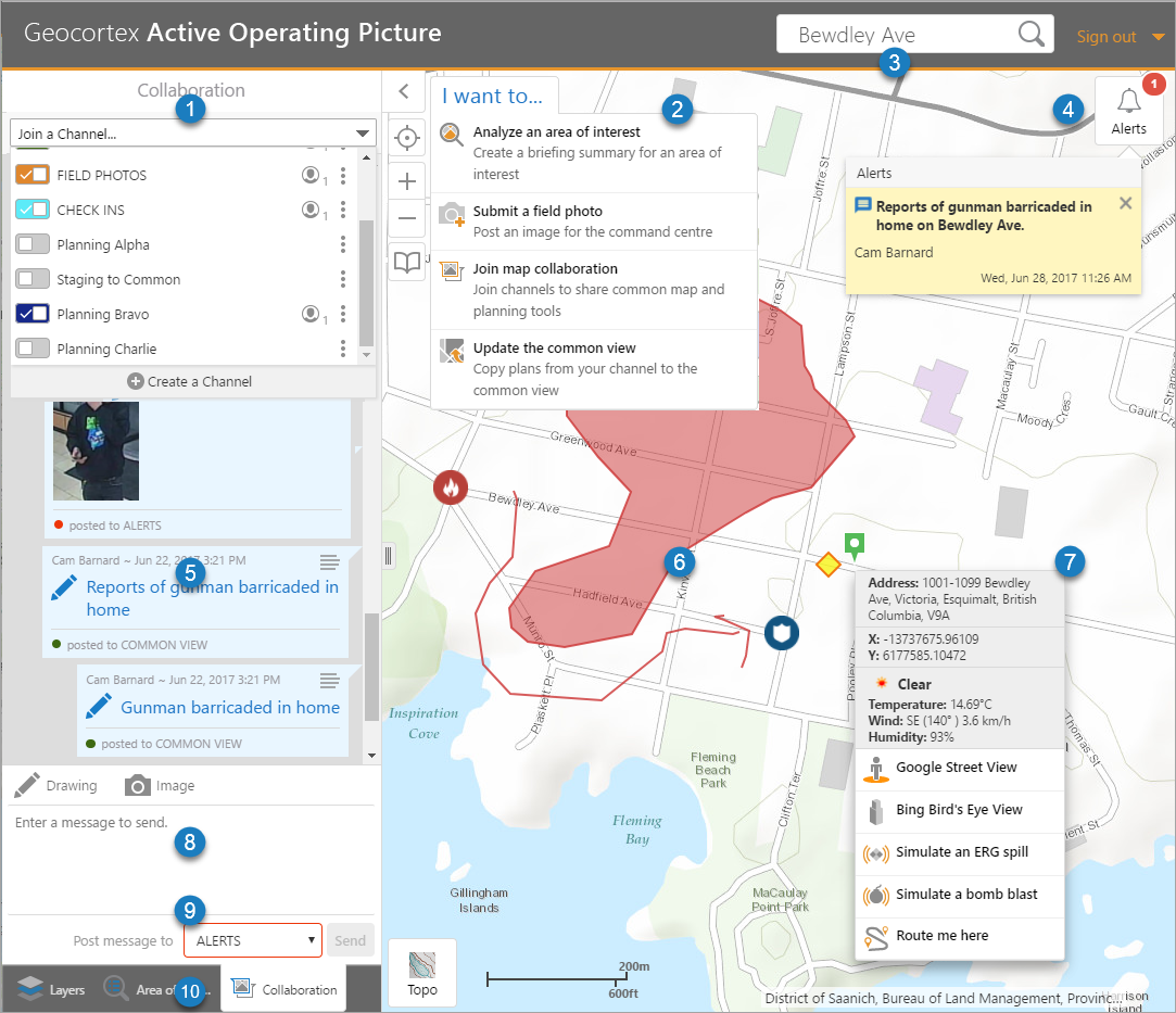
Communication Channels: Click or tap to join communication channels. You can also create a new channel. Each channel you join adds their communication to the display. |

|
I want to menu: Click or tap for quick access to frequently used features like Analyze an area of interest, Submit a field photo, Join map collaboration or Update a common view. |

|
Search: Type in a search term to find data on the map. |

|
Alerts with tooltip: A new Alert appears as a red dot on the Alert icon. The number increments as more alerts come in. Click or tap the alert icon to see the Alert text, the name of the person or system that sent the alert, and the date and time it was sent. Alert Tooltip: Click or tap the alert icon to see the Alert text, who sent it, and the date and time it was sent. |

|
Collaboration Channel Shows messages and alerts posted to the channel. Each message shows the person who sent the message, the time and date it was sent, and which communication channel it was posted to. Multiple channels can be open at once and their feeds will be combined into the collaboration channel view. |

|
Markup and icons on the map Draw shapes to outline an area of interest, add icons that indicate fire or police or other items of interest. Markup can be added in a planning channel and then sent to the common view. |

|
Point on the map Click or tap the map to see the address, coordinates, and weather summary at that spot on the map. You can also quickly change the view to Google Street view or Bing Bird's Eye View. You can use the map features to simulate an ERG spill that draws an evacuation zone on the map and gives you a downwind evacuation area. It also simulate a bomb blast. You can click or use Route me here to draw the fastest route on the map from your current location and to create a set of directions. |

|
Message box Sent a message to the current channel, upload an image or draw on the map. Tap Send to post the message to the channel. |

|
Channel Selector Click or tap the drop-down list to swap to a different channel also select and swap to a different channel. |

|
Navigation tabs Click or tap to change the view or see an Areas of Interest. You can also change the visibility of map layers, see routing information, or create communication channels. |