Active Operating Picture Extension for Geocortex Essentials (AOP) is a mapping application designed to provide simultaneous awareness and fast communication between incident commanders and field teams dealing with life-threatening events. AOP provides immediate, accurate, real-time data and the means to quickly communicate situation updates through a common operating view using tablets and phones. Alerts and communication channels allow collaboration between multiple team members in multiple locations. Speedy access to fast-changing information makes it possible for incident commanders to plan and coordinate with field responders so that they can manage incidents in order to protect lives and property.
AOP is a specialized map that integrates the features and the capabilities of ArcGIS Enterprise, ArcGIS GeoEvent Server, and Geocortex Essentials Manager.
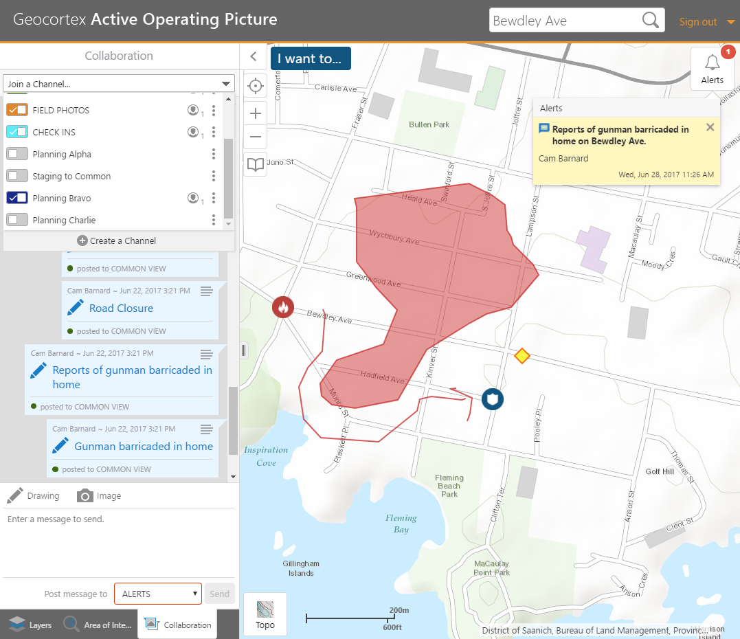
An example of an Active Operating Picture application
From AOP 2.0, extensive changes mean that the application is now an extension that is fully integrated with Geocortex Essentials and Geocortex Viewer for HTML5.
Active Operating Picture Extension for Geocortex Essentials offers the following:
Real-time collaboration between incident commanders and multiple field responders, including simultaneously drawing on a common map.
Multiple, dedicated communication channels to keep track of separate conversations.
Access to Real-time, Fast-changing Information
Custom automatic and manual alerts and notifications for important events both within the application to multiple mobile devices.
Actively updated data integrated and displayed from existing emergency infrastructure and support systems.
Accurate and immediate geographical information to determine the severity and extent of the situation and anticipate future risks.
Reactive addition of map and feature data to existing operating pictures as needs are discovered.
Constant awareness of assets and resources in the field makes it possible to deploy them optimally and to mitigate negative impacts.
Demographic information in areas of interest that may affect rescue operations.
Social media integration to gather additional intelligence from the general public via Twitter and Instagram.
Live weather and traffic information.
Incident playback for debriefing and training purposes.
Makes after-action reporting and analysis possible to improve future planning and decision-making.