Mobile apps use Esri web maps and/or Mobile Map Packages (.mmpk) that make it possible to work either online or offline. Web maps are designed to collect detailed data about features on the map.
In most cases, web maps consist of multiple layers with each layer containing features of a particular kind, for example, a layer for park trees, or a layer for hydrants. On some web maps, each different type of feature is given a different symbol, for example, airports ![]() , schools
, schools ![]() , park trees
, park trees ![]() or hydrants
or hydrants ![]() . The symbols make it easier to identify different feature types on a complex map.
. The symbols make it easier to identify different feature types on a complex map.
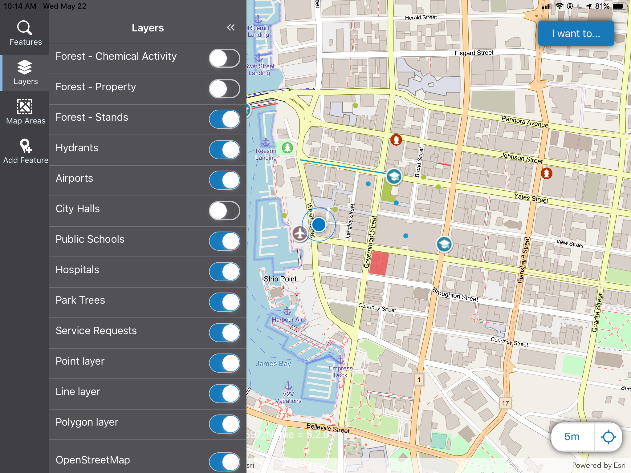
A map with multiple layers and feature types
See also: