A geocoder is a service that converts addresses or names of places into coordinates (and vice versa).
For example, if you search for "Central Park", the geocoder shows suggestions for what you might be interested in.
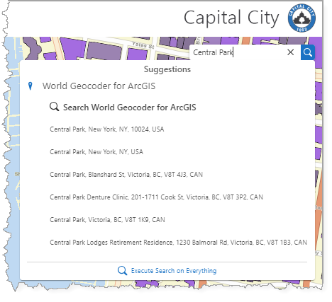
When you click on the suggested address, what actually returns are its coordinates.
Studio Web cannot support multiple geocoders. You can create a composite geocoder, which combines geocoding from many sources into a single locator.
Field |
Description |
|---|---|
Title |
Identifies the geocoder. |
Geocoder Service URL |
The URL of the geocoder service you want your app to use for functions like search and address lookup. The default is the Esri geocoder. |
Zoom Scale |
The target scale for zoom operations. A value of 0 is equivalent to an unset scale; in this case the map will zoom to the closest min/max scale of the result's source, if the map is not already within the visible scale range. |
Country Codes |
Only produces results from the specified countries. If no country codes are provided, results from all countries are shown. |
Categories |
Filters out unwanted geocoder results. Specifying which categories you want to include (for example, landmarks, parks, land features), limits the types of places for which the service searches. This eliminates false positive matches and potentially speeds up the search process. |