The Snapping tool increases accuracy when you create or edit a geometry on the map. This includes editing feature geometries, drawing, and measuring.
Snapping is automatically configured in your map when you add the Drawing tools to the Toolbar.
When you activate Snapping in the toolbar, your cursor jumps (or snaps) to the edges and vertices when your cursor is near them and within a certain tolerance. The snap target indicator emphasizes which vertex or line you are snapping to, shows which layer the snap target is indicating, and identifies whether the target is a point (vertex) or line (edge).
Hold the ALT key to temporarily toggle the state of the snapping while you create or edit a geometry.
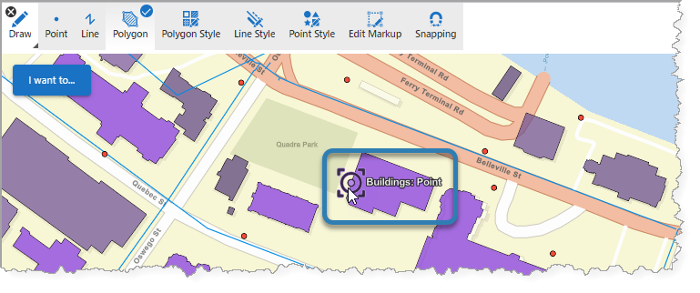
The snap target indicator snapping to a point on the Buildings feature layer.
Studio Web supports snapping in the following layer types:
•Feature Layer
•GraphicsLayer
•GeoJSONLayer
•KMLLayer
•WFSLayer
•CSVLayer
•MapNotesLayer (2D only)
•3D Object SceneLayer (3D only)
•BuildingSceneLayer (3D only)