The Identify tool can be used to identify and list features on the map. Features are listed categorized by layer. Various functionalities can be applied to features selected in the list.
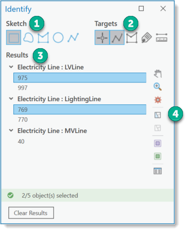
1.Sketch - Different types of sketches are provided for selection in the map.
2.Targets - The feature types to which the selection should refer can be filtered. It is possible, for example, to identify only annotations or only points and lines.
3.Results - A list of all results from the selection process on the map.
4.Functions - All functions are applied to selected features. Both single and multiple selection is possible.
The map section can be moved. Features can be zoomed in or highlighted on the map. Features can be selected or removed in the map. Furthermore, it is possible to specifically toggle the visibility of the layers containing the selected features. I.e., in unclear places the map content can be changed without having to search for the layers in the table of contents. Another button opens the ArcGIS Pro Attributes panel. To open the ArcGIS Pro Attributes panel, at least one feature in the list must be selected by means of Select in the map.
How to identify map features and view their attributes:
1.With the map and the Identify tool open, choose a Sketch and Target type.
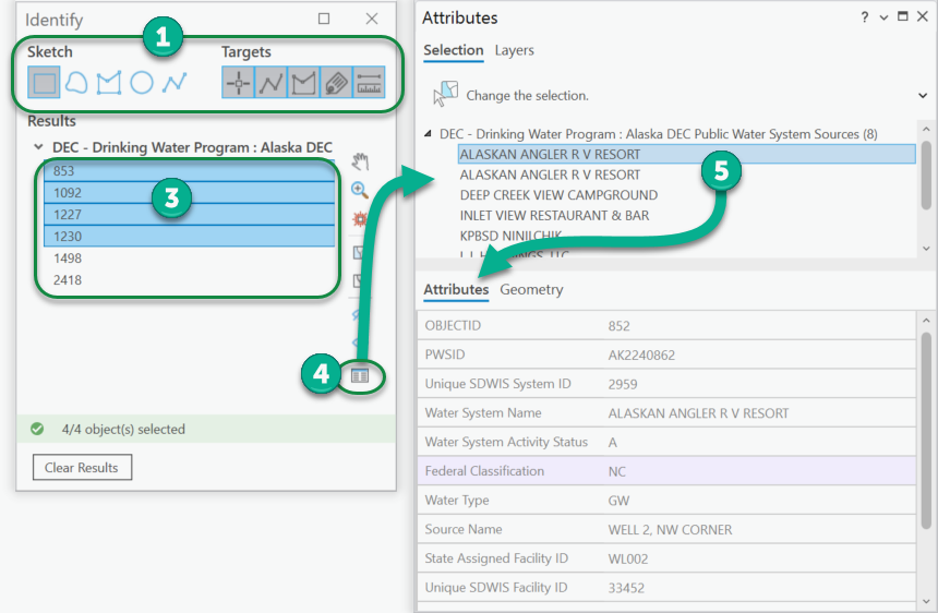
2.Use the sketch tool on the map to select one or more features.
3.Select one or more features from the Results. Use Ctrl + click to select more than one.
4.Click the Show Attributes button to open the Attributes panel. This will show the attributes for the selected features.
5.If more than one feature is in the list, you can select others to see their attributes.