The Printing component is linked to the Print command. You must add the Printing component to the app for the Print command to work.
When your user selects the Print command, the component shows the map area to print, which they can click and drag to adjust. See Run a Print a VertiGIS Studio Web App for more information.
Certain Printing settings are available depending on which of the following print engines you are using:
•Chromium browser-based print engine
•ArcGIS Enterprise-based print engine
You can configure the print settings available when your user prints the map, including the print template settings, spatial reference grids, and resolutions the user can select. The user is also presented with any input parameters the print template may have.
See also: Printing Service.
Standard Settings
Main Settings
Field |
Description |
|---|---|
Title |
The heading to display for the component. The title appears in both Web and Web Designer. |
Icon |
The symbol used to represent the component. |
Resolutions
Field |
Description |
|---|---|
DPI |
The dots per inch (DPI) resolution in which to print the map. |
Visibility Filters
Field |
Description |
|---|---|
Visible To |
Determines which users and groups can access this component. If no users or groups are specified, all users can access this component by default. The Hidden From setting overrides this setting. |
Hidden From |
Determines which users and groups are explicitly forbidden to access this component. This setting overrides the Visible To setting. |
Layout
Field |
Description |
|---|---|
Margin (px) |
The margin space around the component, measured in pixels. |
Initially Hidden |
Specifies whether or not the component is initially hidden when the app loads. If selected, the component remains hidden unless activated, for example, by the Show command. |
Map |
The Map components this component affects. This setting cannot be modified if this component is either a subcomponent of a Map component or there is only a single Map component in the app. |
Button Style |
The style of the button. Choose either Rounded or Square. |
Chromium Browser-based Print Engine Settings
These settings are available if you are using the default Chromium browser-based print engine.
Print Templates
Field |
Description |
|---|---|
Title |
The title to display for the print template. |
Template |
The URL of the print template. |
Spatial Reference Grids
A spatial reference grid defines the coordinate system used to locate the geometry for a feature. It controls how and where features are displayed in a map or scene.
For a list of Well-Known IDS (WKIDs) and Well-Known Texts (WKTs), see Esri's Geographic Coordinate Systems or Projected Coordinate Systems.
Field |
Description |
|---|---|
Name |
The display name of the spatial reference grid. |
WKID |
The unique number assigned to a coordinate system. |
Well-Known Text |
A string that defines all necessary parameters of a coordinate system. The WKID setting overrides the Well-Known Text setting. |
ArcGIS Enterprise-based Print Engine Settings
These settings are only available after you configure the Print Service URL.
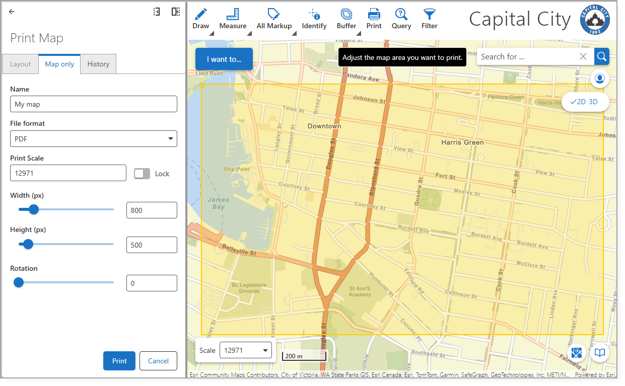
The figure below shows what your user's print settings look like when you configure an ArcGIS Enterprise-based print engine. The Map Only tab is configured by default and cannot be disabled.

ArcGIS Pro Layouts
ArcGIS Pro layouts are the print-ready designs you create to visually display your map.
Field |
Description |
|---|---|
Add ArcGIS Pro Layouts |
Select the ArcGIS Pro layout template you want to use for printing. |
ArcGIS Pro Layout Packages
Layout packages are ArcGIS Pro layouts with several different types of page layouts (Default, Cover, Overview, Legend).
Field |
Description |
|---|---|
Add ArcGIS Pro Layout Packages |
Select the ArcGIS Pro layout package you want to use for printing. You must configure the layout package in VertiGIS Studio Desktop and publish it to the ArcGIS Portal. |
Overview Map
The Overview Map is a map frame in a print layout that displays a zoomed-out view of the main map's extent. In VertiGIS Studio Web, you can now configure this frame to use a specific web map.
If you create or use map frames with custom names (anything other than the recognized “OVERVIEW” or “WEBMAP_MAP_FRAME”), you cannot assign a web map to those frames through Studio Web Designer. They will still work, but you cannot configure them with a specific web map in Studio Web.
Field |
Description |
|---|---|
Web Map |
Browse to select your web map. The selected web map is used as the Overview Map in your layout. If no web map is selected, the application map is used as the default. |
Overview Page Map
The Overview Page map is a map frame in a print layout that shows the entire page layout in relation to the map’s extent. Like the Overview Map, it can be assigned a web map in Web Designer.
If you create or use map frames with custom names (anything other than the recognized “OVERVIEW” or “WEBMAP_MAP_FRAME”), you cannot assign a web map to those frames through Studio Web Designer. They will still work, but you cannot configure them with a specific web map in Studio Web.
Field |
Description |
|---|---|
Overview Page Map |
Browse to select your web map. The selected web map is used as the Overview Page Map in your layout. If no web map is selected, the application map is used as the default. |
Scales
Use the Scales section to configure predefined map scales that users can choose from when printing a map. The value must be between 1 and 50,000,000.
For example:
•1:200
•1:1000
•1:5000
•1:10000
You can add several predefined scales and use the Allow other scales setting to determine whether end users can specify their own print scale.
Map Only
When enabled, the Map Only tab appears in the Print Map dialog.
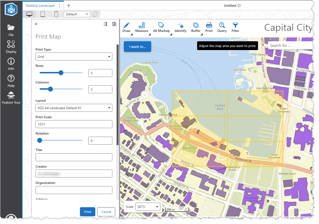
When enabled, Grid is available as a Print Type in the print form. The print area window appears in a grid pattern, which you can define with the Rows and Columns settings.

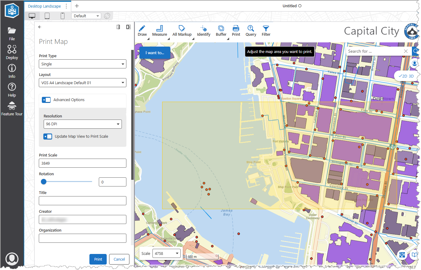
When enabled, Single is available as a Print Type in the print form. The print area window appears as a single square for you to define the area of the map to print.
When Update Map View to Print Scale is enabled, the map view is set to print scale during printing to capture out-of-scale layers.
