Survey data can be imported into existing or newly created feature classes. GPX Data, and CSV files containing data in following formats are accepted:
•WKT
•X/Y
•X/Y/Z
•Latitude/ Longitude
•GeoJSON
•ArcGIS JSON
To import survey data:
1.Navigate to Import and click Import Survey Data.
The Import Survey Data panel opens.
2.Click the Browse button to open the Import Data File window.
3.Select the data file and click OK.
Supported file types include GPX and CSV. Make sure you specify the file format to ensure you can see all files of that type.

If you selected a CSV file:
•Select the Separator.
•Specify whether you want to Treat first row as header.
Optional: Enable Attribute-based import to select a field whose values are displayed in the next window. You can then choose which values to import. Only records with the selected values are imported.
The import file is validated automatically. Information about the detected attribute fields appear in the Attribute Import File section.
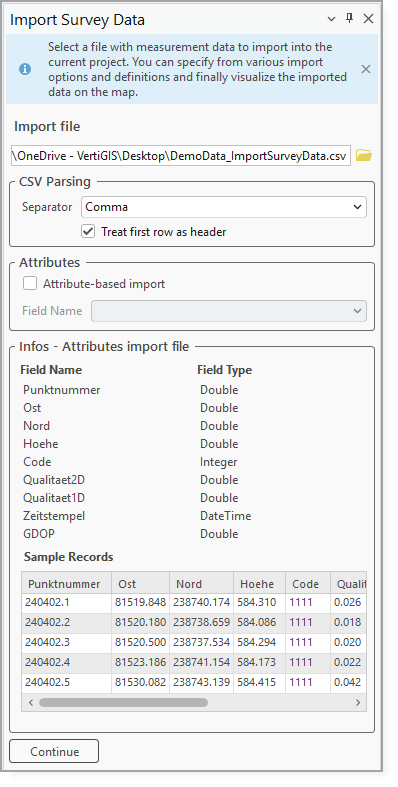
4.Click Continue to advance to the Input Data panel.
5.Choose the Target Layer (the layer that you want the data imported to). All feature layers of the current map are available to choose from.
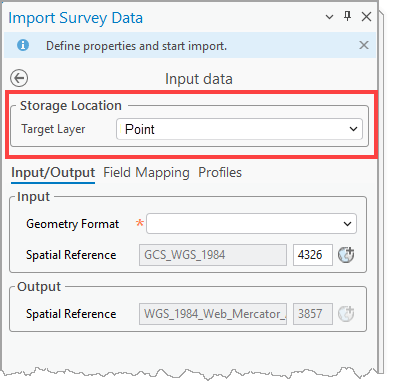
Alternatively, you can create a new feature class in a database by specifying a Table Name and an Alias Name. In this case, a database must be selected, accepting FGDB and SDE connection files.
If Pick Feature Dataset is enabled, an existing feature dataset must also be selected in the targeted Geodatabase. This has the advantage that the coordinate system is implicitly predefined, requiring no further user inputs.
6.Continue to enter the inputs for the following tabs:
The input fields available in each of these tabs are dependent on the import format.
7.Configure optional settings.
8.Click Start Import.
When the import runs,each record is evaluated and imported into the appropriate layer automatically.