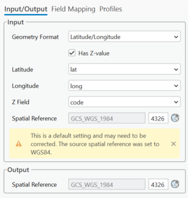
The Input/Output tab is used to configure the source data, target dataset, and coordinate system settings required for the import. The available options depend on the selected import format and the information contained in the source file.
To import spatial data correctly, you must verify the following:
•The coordinate system of the source data.
•The coordinate system of the target dataset.
•Any required geographic (datum) transformation when the source and target coordinate systems use different datums.
•The destination dataset and, when applicable, the field mapping configuration.
Some file formats include coordinate system information, while others do not. When the coordinate system cannot be determined from the source data, Studio Desktop attempts to provide a suitable default or recommendation and displays a warning if additional configuration may be required.
Review these settings before starting the import to ensure the data is placed correctly.
You can save the Input/Output, Spatial Reference System, and Field Mapping settings as a profile for reuse. Profiles can be stored in the current project, a Portal item, or a local folder.
Coordinate System Examples
The required coordinate system settings vary depending on the input format.
The coordinate system examples include the following:
•CSV files contatining X/Y coordinates
•CSV files containing ArcGIS JSON geometry
•CSV files containing latitude and longitude values
GPX Files
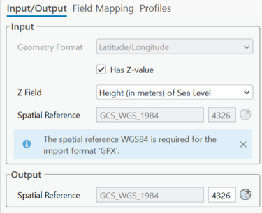
GPX files always use the WGS 1984 coordinate system. If the target dataset also uses WGS 1984, no geographic transformation is required.
CSV Files Containing X/Y Coordinates
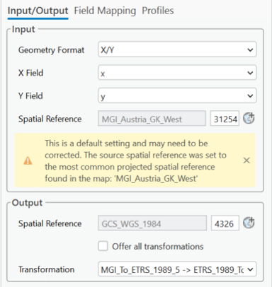
CSV files containing x/y coordinates do not include coordinate system information. Select the coordinate system that matches the source data. If the source and target datasets use different datums, specify an appropriate geographic transformation.
CSV Files Containing ArcGIS JSON Geometry
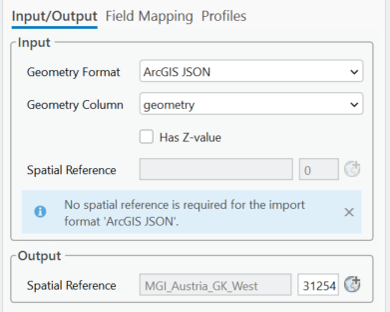
CSV files containing ArcGIS JSON geometry include the coordinate system information with each geometry. If the target dataset uses a different datum, specify the appropriate geographic transformation.
CSV Files Containing Latitude and Longitude Values
CSV files containing latitude and longitude values do not identify the coordinate system. Determine the correct coordinate system from the data source or its metadata. Studio Desktop defaults to GCS_WGS_1984 and displays a warning so you can verify that the setting is correct.